Squaxin Island Tribe Deeply Concerned About State Chum Fishery

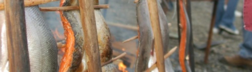
The Squaxin Island Tribe is calling foul on the Washington Department of Fish and Wildlife for continuing a commercial chum salmon fishery despite deep doubts about the run.

The chum salmon runs in deep South Sound are all native stocks, and all managed for natural production.

“Today, the Department decided to continue its chum fishery, even though the escapement levels necessary to sustain the Kennedy Creek native stock is at less than 20 percent of what is expected at this time of year,” said tribal chair Arnold Cooper. “We decided some weeks ago not to fish, in order to ensure that enough fish returned to the river to spawn.”

Puget Sound tribes have harvested 50,000 chum. Despite warnings, and the unanimous recommendations of the tribal co-managers to stop, WDFW refuses to close the fishery and has now harvested 150,000 fish. For 2015-2017 combined the state commercial take has exceeded tribal harvest by more than 200,000 fish. Further, WDFW closed its Hood Canal fishery to non-Indian gillnetters and encouraged those fishers to move into Puget Sound, putting further pressure on the Kennedy Creek chum and increasing the risk that escapement will not be met.

The Department of Fish and Wildlife takes no lesson from the history of over-fishing stocks toward endangered status, Cooper said.

“Has the State learned nothing? The State wants to fish today and ignore tomorrow. It is irresponsible. When the co-manager alerts you to a problem in real fish, they need to stop telling us that the computer model says there is plenty of paper fish and there is no problem.”

The tribal and state co-managers largely agree on the estimated run size and have conducted in-season test fisheries to adjust the run size. The models that are used for management presume that a certain escapement will occur for a given run size. However, the expected escapement is more than two weeks overdue with no fish at or near the river mouth.

“The state ignores the warning, on the hope that the rains will come, the rivers will rise, and the fish will show up. The tribe hopes that is so, but is not willing to risk the run,” Cooper said.

“The Department’s mission is to “preserve, protect and perpetuate fish .., while providing sustainable fish and wildlife recreational and commercial opportunities,” Cooper said. “The Tribe has asked the Department to live up to its mission statement and stop fishing the Kennedy Creek chum run. The department has refused. That is wrong. The department’s actions are a direct threat to the perpetuating the native run and to having a sustainable fishery. The Department must stop,” he said.

Contact:
Joseph Peters 360.490.6825
Arnold Cooper 360. 490.7933

Planting Juvenile Coho in the Deschutes River

The Squaxin Island Tribe and the Washington Department of Fish teamed up this past June to release thousands of coho fry into Spurgeon Creek a tributary of the Deschutes River.

You can watch videos of the release here  and here

The Deschutes River system used to have a robust run of naturally spawning coho. This ended in the late 1980’s due to habitat degradation in coho spawning areas and decreases in marine survival along the entire west coast. Coho salmon generally spend 1.5 years in freshwater and 1.5 years in the ocean. This makes them especially vulnerable to changes in stream habitat and ocean conditions.

Coho salmon return to the stream they were born after three years. This means that a run of coho is made up of three different year classes or cohorts. In the late 1980’s one of these cohorts was considered essentially extinct because it was not producing enough fish to maintain the population. Starting in the mid 1990’s a second cohort also became functionally extinct.

Yearly plantings of juvenile coho will likely continue while in-river restoration and conservation projects are implemented and studies on the impacts of ocean conditions  such as the Salish Sea Marine Survival Project continue.

Return of adult coho to the Deschutes River 1980-2014:

Return of adult coho to the Deschutes by cohort/year class 1997-2014


Shelton Harbor Restoration

We are pleased to announce the kickoff of a project designed to restore the Goldsborough and Shelton Creek estuaries in Shelton Harbor. When complete the project area and other high quality habitat in the harbor will be placed into permanent protection.

Existing conditions.

Shelton Harbor existing conditions.

Conceptual drawing showing completed project.

Conceptual design for the completed project.

The overall project involves-

Landowners: Simpson Lumber, Sierra Pacific Industries and the Port of Shelton.

Partners: South Puget Sound Salmon Enhancement Group, Mason Conservation District, Capitol Land Trust and the Squaxin Island Tribe.

Funding obtained to date has been provided by the Washington Department of Ecology National Coastal Wetlands Conservation Grant Program (information here) and the Salmon Recovery Funding Board (SRFB, information here). Significantly, all of the Lead Entities present in South Puget Sound contributed to the project enabling the SRFB to increase the amount of money available.

The project is large in scope and when complete will:

  • remove 811 creosote pilings
  • remove 1/2 mile of armored shoreline
  • remove 1/4 mile of inter-tidal dikes
  • restore 47 acres of saltmarsh
  • restore 1/2 mile of shoreline riparian
  • conserve 51 acres of tidelands and over 14 acres of riparian upland

The partners are currently in the permitting phase and anticipate construction to begin in the summer of 2017. To keep informed of the project status we have created a website sheltonharbor.org. Check in regularly for updates.


Kindergarteners Burfoot Park Field Trip, Puget Sound Sea Life, Scuba Divers too!


Burfoot 9 Griffin kindergarten student examines a sea star.

It’s that time of year when classrooms take a day to go on an end of the year field trip, somewhere fun, but somewhere educational.  On Tuesday May 24th, Griffin School and Olympia Regional Learning Academy (ORLA) kindergarten classes planned a trip to Burfoot Park along Budd Inlet, where they were greeted by Squaxin Island Tribe Natural Resources staff  in scuba gear and two wading pools full of sea life.    “It’s always fun to do this for the students.  To see the excitement in these young learners faces when we come to shore in all our scuba gear is priceless,” says Joseph Peters, Natural Resources Policy Representative for Squaxin Island Tribe.

Burfoot 7 Burfoot 10

This is the second year that Griffin School kindergarten classes have coordinated with Squaxin Island Tribe Natural Resources to have a “touch tank” of sea life for the class to learn about.  It was great that we could extend this to be a full day event so ORLA could participate in all the fun.   The hope is that we can make an impression on these young students about the importance of the Puget Sound and the life it contains.

Burfoot 3

Joe Peters and Scott Steltzner of Squaxin Island Tribe Natural Resources answer questions about Puget Sound sea life.

“Watching them interact with the sea stars, crabs, moon snails, and other sea creatures is amazing.  We like to keep our eye on those kindergarteners that stay around the touch tank the longest.  Those kids are our future marine biologist or scientists”, boast Peters.  There are plans to do this again next year with Griffin and ORLA. Squaxin Island Tribe Natural Resources does a number of educational outreach activities throughout the year.  Over three days in late April the Tribe and Shelton School District conducted the First Grade Field Experience.  First graders from Evergreen, Mountain View, and Bordeaux Elementary visited Arcadia Point where Squaxin Island Tribe set up three exploration stations and traditional story telling station.  Explorations stations included touch tank, watershed demonstration, and scavenger hunt.

Burfoot 1

Candace Penn, Joe Peters, & Scott Steltzner of Squaxin Island Tribe Natural Resources discuss Puget Sound sea life with Kindergarteners.

Burfoot 4

Even more bad news coming for South Puget Sound salmon returns

IMG_1555

This year’s forecasts for coho coming back to the deep South Sound show the lasting impact of poor marine survival caused by the recent Pacific Blob, a large area of warm ocean water. For example, this coming year, only 1,800 coho that originated from the Squaxin Island Tribal net pens program are expected to return.

Usually over 25,000 Squaxin net pen coho return yearly from 1.8 million released. Historically, the net pen program’s survival has been as high as 3 percent in recent decades, but has dipped down to 1.1 percent the last few years. This year, the fish produced by the program will likely only have a 0.117 percent survival rate.

And, this is because of the lasting impacts of poor marine survival caused by the blob, even though it likely died this last fall.

Coho returning this year still spent enough time in the ocean that their survival was hurt by the blob’s warm water conditions.

NOAA fisheries recently pointed out how the area of warm water in the north Pacific Ocean turned everything upside down in terms of the ocean food chain:

“When young salmon come out to sea and the water is warm, they need more food to keep their metabolic rate up, yet there is less available food and they have to work harder,” said Elizabeth Daly, an Oregon State senior faculty research assistant with the Cooperative Institute for Marine Resources Studies, a joint program of OSU and NOAA.

“Our long-term data set contradicts the long-held assumption that salmon eat less during warm-water regimes,” Daly added. “They actually eat more. But they still don’t fare as well. When the water is warm, salmon are smaller and thinner.”

During the last two years, an unusually large, warm body of water has settled into the ocean off the Pacific Northwest that scientists have dubbed “The Blob,” which is forecast to be followed this winter by a fairly strong El Niño event. Though recent spring Chinook salmon runs have been strong due to cooler ocean conditions in 2012-13, the impact of this long stretch of warm water on juvenile fish may bode poorly for future runs.

“So far this year, we’ve seen a lot of juvenile salmon with empty stomachs,” Daly said. “The pressure to find food is going to be great. Of those fish that did have food in their stomachs, there was an unusual amount of juvenile rockfish and no signs of Pacific sand lance or krill.

“Not only does this warm water make it more difficult for the salmon to find food, it increases the risk of their own predation as they spend more time eating and less time avoiding predators,” she added.

The blob being replaced by a strong El Niño still means bad news for salmon survival.

El Niño is generally a warming of the Pacific Ocean that will likely last at least through this spring.

Last year’s returns of pink and coho salmon showed the devastating impacts bad marine survival can have on fisheries. Squaxin tribal fishers spent several frustrating weeks last fall landing fewer coho that were undersized as well.

Many of the fish we caught were about half the size of the fish we usually see. This was hard on our fishermen because for the same effort, their landings had much less value.

The Squaxin Tribe practices a protective fishing regime, focusing its efforts away from bays and harbors where wild coho congregate, fishing instead where plentiful hatchery-origin fish hang out.

Poor marine survival threatens the return of hatchery fish too, and will continue to hurt the tribe’s fishing-based economy and local sport fisheries. The Squaxin net pens program releases 1.8 million coho each year. When these fish returning as adults, they contribute to both sports fisheries through out Puget sound as well as tribal fisheries.

This decline in coho is devastating for both tribal and state-managed fisheries.

Collier Boat Ramp and Jetty Restoration

The Squaxin Island Tribe, working with our partner the South Puget Sound Salmon Enhancement Group http://spsseg.org/, recently completed a project to remove a boat ramp and large concrete structure that had  been used as a boat basin.

Both of these structures blocked the natural movement of sediment down the beach. Why is this important? This beach materiel is used by sand lance and surf smelt to lay their eggs. These, and other fish, are called Forage Fish because they provide a critically important food base for salmon and other creatures in Puget Sound. Blocking natural sediment movement causes the beach to cut down decreasing the available space for forage fish to spawn.

OLYMPUS DIGITAL CAMERA

Before: Boat ramp with marine railway.  The concrete blocks sediment from moving as shown by the elevation difference on either side.

OLYMPUS DIGITAL CAMERA

Before: Boat basin that had been used as a “dry dock” by the previous owner. This structure blocked sediment from moving down the beach.

The energy generated from waves breaking along the beach at an angle moves sand and sediment along the shoreline. We call areas where this happens over long stretches of beach Drift Cells as the sediment tends to drift or move in one direction. Structures located on the beach can block this sediment movement causing the beach to pile up on one side and down cut on the other.

In the early 2000’s the Tribe initiated a project to identify and rate beach sediment sources within Totten Inlet. The drift cell along the project area was found to be one of the longest in all of South Sound. This drift cell was rated as having a good sediment supply, called feeder bluffs as they feed sediment to the drift cells, and was found to be in generally good shape. Three structures were identified that blocked sediment movement down the beach. The first of these, the Arcadia Point boat launch, was fixed in 2011 when a solid concrete ramp was replaced with one that had channels that allow sediment to flow through.

AracdiaPointBoatRamp2

Arcadia Point Boat Launch. Sediment channels are placed between concrete planks allowing sediment to flow through from left to right.

The other two structures were the Collier boat ramp and jetty. Sediment can now move unimpeded on this over five mile long drift cell.

IMG_20151104_113514767

After: The boat basin has been removed. Sediment can now flow down the beach unimpeded.

You can watch a YouTube video showing the construction project here:

Each dock counts towards hurting salmon

OAQN7p copyHow much progress are we really making in restoring Puget Sound?

On one hand, community partners get together with us here at the tribe and at local governments to push forward a few habitat restoration projects a year. At the very most.

But, on the other end, dozens and dozens of shoreline development projects seem to sail through the local permitting process. Each of these projects is small on its own (a new bulkhead there, a dock here), so no one is bound to complain.

But, these tiny projects all put together are having a massive impact on Puget Sound, and its ability to produce salmon.

Nearshore habitat provides a critical nursery for juvenile salmon as they prepare to make their seaward migration, and also serves as migration corridors for returning adult salmon.

Here’s the short course on how these tiny developments can add up:

One way things like bulkheads and docks damage the environment is by disconnecting land and marine ecosystems. This disconnection prevents things like logs and bugs from entering and moving along the water, which ultimately alters the food chain and eliminates important habitat.

Another impact from shoreline modification is that it affects currents, which change where and how much sand is deposited. This in turn harms habitat of forage fish and invertebrates that are an important source of food for young and returning adult salmon.

But, I see dozens of these projects go through, with no mind paid to what the total impact of all the projects ever permitted is having.

Every letter we receive from Pierce County about yet another bulkhead or dock somewhere in Puget Sound includes language like this:

What does that mean in everyday language?

The County insists that this dock (or bulkhead on its own) isn’t a problem. But, they’re not going to actually look at its individual impact. Also they are not going to look at cumulative impacts to find out if this is the straw that breaks the camel’s back. Or, in this case, Puget Sound’s back.

SQ blog
And, what does that look like on the ground?

Here’s a visualization of Horsehead Bay (you can see a larger version here), which in its natural state would be great rearing habitat for juvenile salmon. But, when you add a few dozen docks, the value to salmon plummets.

SQ docks animation for web 500px

Intertidal Forage Fish Training with WDFW, Its an Egg Hunt!

IMG_2185

Phillip Dionne pictured in blue holding the plastic bag

We were lucky enough to have Phillip Dionne from WDFW join us at the Natural Resource Department. He gave a presentation about forage fish and there critical habitat along the shores of Puget Sound. Forage fish lay their eggs in the sand-gravel beach zone as well as the outer tide flats. A substantial amount of forage fish spawning habitat has been lost or destroyed by the high impact of shoreline usage and development in Puget Sound. As you can see below the shoreline is armored and because of the location forage fish spawn it makes them vulnerable to shoreline development and other human actions.

IMG_2188

Example of shoreline armoring and example of forage fish spawning habitat survey

The need for public education about forage fish and their ecological role is constant to maintain a well-informed community. Many people are unaware of just how many species utilize the shoreline; forage fish being a few of them. The term “forage fish” can be broadly applied to many species that are, in many cases, related through ecology and not phylogeny. Pacific herring Clupea pallasii, Northern anchovy Engraulis mordax, Pacific sardine Sardinops sagax, Surf Hypomesus pretiosus, Longfin Spirinchus thaleichthys, Pacific sand lance Ammodytes hexapterus, and Rock sole Pleuronectes bilineatus are just a few species that use the shorelines. For a map of spawning activity please visit, http://wdfw.wa.gov/conservation/research/projects/marine beach spawning/

IMG_2191

Natural Resource Crew watches as Phillip Dionne demonstrates, “The Vortex Method”

IMG_2180 IMG_2177 Phillip Dionne (WDFW) giving a demonstration on laboratory procedures for recovering forage fish eggs

Squaxin Island Tribe, land trust, turning golf course into habitat

Bayshore on Oakland Bay. Photo by the state Department of Ecology.

Bayshore on Oakland Bay. Photo by the state Department of Ecology.

The Capital Land Trust and the Squaxin Island Tribe are working to bring back salmon habitat and protect an important shellfish growing area by restoring a former golf course on Oakland Bay. The land trust recently purchased the 74-acre Bayshore Golf Course, which includes the mouth of Johns Creek and over a thousand feet of Oakland Bay shoreline.

The tribe and the land trust will remove a 1,400 foot dike, restoring the Johns Creek estuary and important marine shoreline. “Taking the dike out will provide salmon with additional acres of saltwater marsh to use as they migrate out to the ocean,” said Jeff Dickison, assistant natural resources director for the tribe..

Eventually, the golf course fairways will also be replanted with native vegetation, restoring a streamside forest that helps provide habitat to salmon.

Preventing development around the bay also protects the most productive shellfish growing area in the state.

The former golf course sits on a peninsula jutting into Oakland Bay that is made up of mostly gravelly glacial outwash. “If the golf course had been sold to developers, the porous nature of the gravel underneath the golf course couldn’t have protected shellfish beds from being polluted by septic tanks,” Dickison said.

The mouth of Johns Creek was the site of one of the largest longhouses and Squaxin villages. “We have always thought of this place as special,” said Andy Whitener, natural resources director for the tribe. “Our people lived there for thousands of years, subsisting on the fish, shellfish and wildlife that was always available.”

The state Department of Ecology also helped the land trust buy the surface water rights associated with the golf course. “Johns Creek doesn’t have enough water to support a weak run of summer chum,” said Scott Stelzner, salmon biologist for the tribe. “By securing this water right, we can balance against increased water appropriations throughout the Johns Creek watershed.

The restoration of the old golf course is part of a larger effort to protect and restore Oakland Bay. The tribe, the land trust and other local partners have protected hundreds of acres of habitat and improved water quality throughout the bay.

“It is important to make sure we protect places like Oakland Bay, before they turn the corner and can’t be saved,” Dickison said. Currently, Oakland Bay is relatively undeveloped, but that could easily change in the next few years.

“The decline of salmon and shellfish directly impacts our culture, economy and our treaty reserved rights,” Whitener said. “Making sure Oakland Bay is healthy is one of the most important things we can do to protect our way of life.”

Week 45 Apple Tree Cove Test Fishery Update

Chum caught by a Squaxin Fishermen during a Totten Inlet Drift fishery November 2013.

Chum caught by Squaxin Fishermen during a Totten Inlet Drift – November 2013.

The week-45 South Sound chum test fishery at Apple Cove Point provided decent catches yesterday but nothing spectacular. They caught at total of 902 chum (plus 10 coho and 2 immature Chinook) in six sets which compares pretty well with historic week-45 catches. The tides were not ideal, ebbing during all but the first set. The proportion of females in their sample rose this week to 59%. The overall catch appeared to have more small fish, scales samples had not been delivered to the WDFW scale lab in time enough to be shared at this time, so we won’t have the age distribution. Many of the fish were still quite bright.

Models supported an update to the South Sound chum runsize ranging from 550,000 to 750,000.

Non-treaty fleet to date has caught 148,648 fish.  This week Non-treaty had 63 Purse Seine boats with a total of 25,000 chum caught.  Two thirds of the fleet was in area 10.   

Total Tribal catch to date is  94,855 fish. Tribal catches appeared to be lower this week for the northern tribes.  Squaxin Island Tribe was the only tribe to be showing a substantial increase in catches.  Squaxin total catch as of November 7th is 32,405 chum.  

Based on the Week 45 models and regional catch data the Tribes and WDFW agreed to update the runsize to 600,000.  This is down 60,000 from Week 44.  This decrease in runsize adjusts the Treaty share to 268,959 and the Non-Treaty Commercial hare to 261,476. Leaving approximately 174K left of Treaty and 112K left for Non-treaty commercial to harvest.